Dokdo, dependency of Ulleungdo
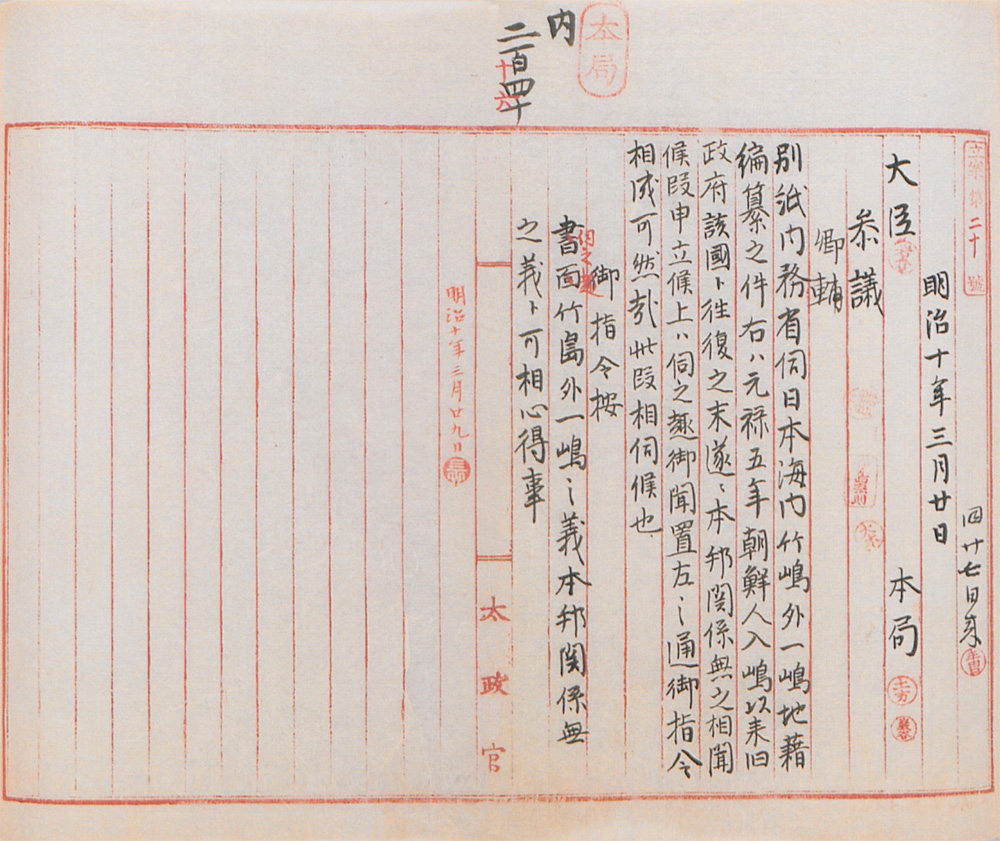
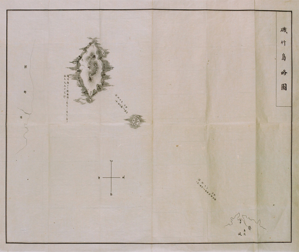
07. Dajokan Order, Isotakeshima Ryakuzu (Simplified Map of Isotakeshima) (1877, Japan)
Dajokan Order, Isotakeshima Ryakuzu (Simplified Map of Isotakeshima)
Dajokan Order, Isotakeshima Ryakuzu (Simplified Map of Isotakeshima) (1877, Japan)
This order was given by Dajokan, the highest administrative body of the Japanese government at the time, to the Japanese Ministry of Home Affairs at the Ministry's request for a final decision on the question of whether to include Ulleungdo and Dokdo in Japan's land registry. Through this order, Dajokan made clear that the two islands were not part of the Japanese territory.
“Simplified map of Isotakeshima” included in the documents attached to the request submitted to Dajokan by the Ministry of Home Affairs, shows clearly that “one other island” in the Dajokan order refers to Dokdo, as depicted in the center of the map.
[Translation]
Regarding Takeshima (Ulleungdo) and the other island (Dokdo), keep in mind that Japan has nothing to do with them.
[Original Text]


